EN

Right spot. Better surf.

Your ultimate surfing dashboard

We don’t predict waves — we explain the spot

Know where it works — and what to avoid

All the parameters.
In one place.

Wind. Tide. Direction. And more.
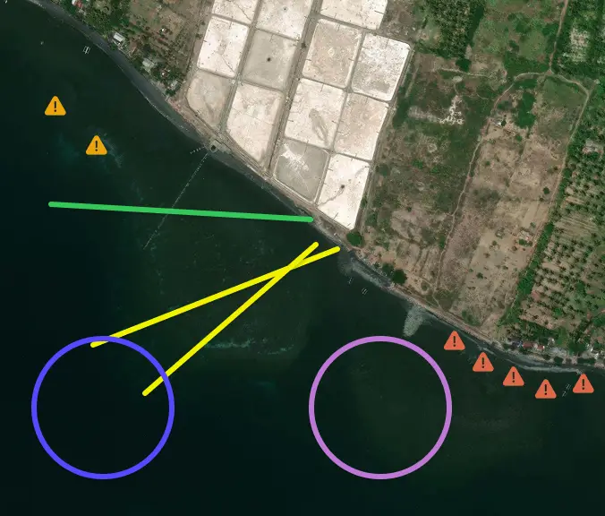
Вход на лайнап
Вход из лайнапа
Большие волны
Умеренные волны
Опасные зоны
Опасное течение
Entry points. Hidden rocks. Dangerous zones. The details you usually learn the hard way
Now explained clearly — before you paddle out
WIND
Local time: 04:10 PDT
WIND
SWELL
Air
16°C
Sea
18°C
Direction
120° W
SEASONALITY
From mid September to late November
HIGH TIDE
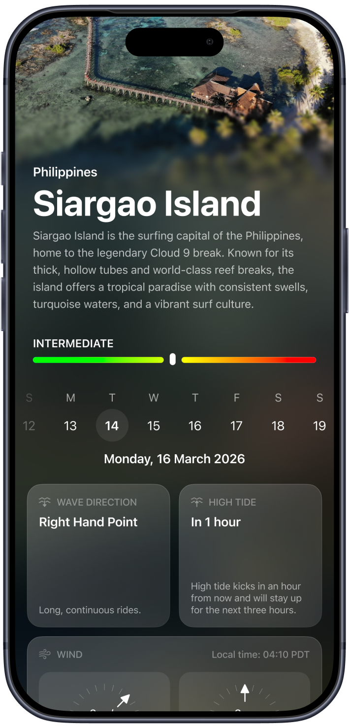
In 1 hour
High tide kicks in an hour from now and will stay up for the next three hours.
TIDE CHART
Low
7:55
High
15:13
Low
18:04
Sunrise
6:02
Sunset
19:33
Last Light
19:59
Size
40ft
Period
20s
Energy
30 kj
Tide Chart
High Tide
Seosonality
Wind
Wave Direction
High Tide
Relief
Hazards

We don’t just show spots — we explain them

Vision

Welcome to the wave! We're beyond excited to have you on board as we revolutionize the surfing experience by providing real-time insights and uncovering amazing surf spots from every corner of the globe. Prepare yourself to ride the future of surfing with us, where endless possibilities await on every wave you catch. Dive in and explore a whole new world of surfing adventures like never before!
Live Cameras on Surf Spots
Install 24/7 live cameras on surf spots to provide real-time ocean conditions directly from the lineup.
Download Your Surf Sessions
Allow surfers to save and download their sessions directly from our camera network.
Bottom & Reef Mapping
Use professional echolocation scanning to visualize underwater terrain, reefs, and dangerous zones around surf spots.
Discovering New Surf Spots
Research and document unexplored and lesser-known surf spots across Bali and the Indonesian islands.
Worldwide Expansion
Gradually expand the platform and infrastructure from Indonesia to surf destinations around the world.

Live From The Lineup

Real-time view from our camera on the spot.
Live
Bali
Uluwatu
2 m/s
Right Hand Point
12s Long Period
+8 more

Help us
build it faster

We're building real surf infrastructure — cameras, mapping, and local data. Every contribution helps us launch new spots and improve accuracy.
PTZ camera per spot
Axis Q6225-LE
≈ $3 500
Camera setup
Mounting & calibration
≈ $500
Bathymetric survey per spot
Mid-level seabed mapping
≈ $2 000

How it works

Вход на лайнап
Вход из лайнапа
Большие волны
Умеренные волны
Опасные зоны
Опасное течение
TIDE CHART
Low
7:55
High
15:13
Low
18:04
Sunrise
6:02
Sunset
19:33
Last Light
19:59
Size
40ft
Period
20s
Energy
30 kj
WIND
Local time: 04:10 PDT
WIND
SWELL
Air
16°C
Sea
18°C
Direction
120° W
SEASONALITY
From mid September to late November
HIGH TIDE
In 1 hour
High tide kicks in an hour from now and will stay up for the next three hours.

Enjoy precise and dynamic dashboard

We are the app that tracks over 100 parameters to help you surf better. Our precise and dynamic dashboard provides detailed insights tailored for each surf spot, ensuring you have all the information you need for the perfect wave.

Built on real surf experience

12+
Years in the water
100s
Sessions across Bali
The kind of knowledge you usually gain over years — now built into the app.
You don't learn a spot from a forecast. You learn it from locals.
Igor Mosur
Surfer · 12+ years in the water
Built with experienced surfers in Bali

Vision

Welcome to the wave! We're beyond excited to have you on board as we revolutionize the surfing experience by providing real-time insights and uncovering amazing surf spots from every corner of the globe. Prepare yourself to ride the future of surfing with us, where endless possibilities await on every wave you catch. Dive in and explore a whole new world of surfing adventures like never before!
Live Cameras on Surf Spots
Install 24/7 live cameras on surf spots to provide real-time ocean conditions directly from the lineup.
Download Your Surf Sessions
Allow surfers to save and download their sessions directly from our camera network.
Bottom & Reef Mapping
Use professional echolocation scanning to visualize underwater terrain, reefs, and dangerous zones around surf spots.
Discovering New Surf Spots
Research and document unexplored and lesser-known surf spots across Bali and the Indonesian islands.
Worldwide Expansion
Gradually expand the platform and infrastructure from Indonesia to surf destinations around the world.

Help us
build it faster

We're building real surf infrastructure — cameras, mapping, and local data. Every contribution helps us launch new spots and improve accuracy.
PTZ camera per spot
Axis Q6225-LE
≈ $3 500
Camera setup
Mounting & calibration
≈ $500
Bathymetric survey per spot
Mid-level seabed mapping
≈ $2 000

Surf smarter

Know where it works — and what to avoid